Travel Planner
“Michigan State Parks of the Upper Peninsula”
Episode #2009 Travel Planner
It wasn't until the onset of the twentieth century that things like admiring nature became fashionable in the United States. People like president Theodore Roosevelt, and author John Muir, helped to popularize setting aside public lands for the preservation of wildlife and other natural resources. Because of this foresight, Michigan's residents and visitors can enjoy one of the nation's premier park systems.
Straits State Park
Mackinac County
Location: 720 Church Street - St. Ignace MI, 49781
Size: 181 Acres
Camping: 2 Mini-Cabins, 2 Group Use Sites, 15 Semi-Modern Campsites, 255 Modern Campsites
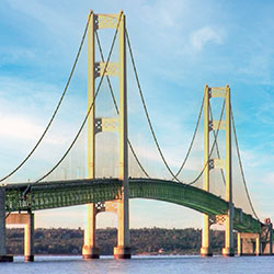
Straits State Park is home to 181 acres of recreation with fantastic views of the Mackinac Bridge and Straits of Mackinac. The park features a campground, overnight lodging facilities, picnic areas, viewing platforms, a playground and a waterfront area along Lake Huron. The North Country Trail goes through the park, a portion of which travels along the park’s 1-mile hiking trail.
- Straits State Park [Michigan DNR]
Brimley State Park
Chippewa County

Location: 9200 W. 6 Mile Road - Brimley MI, 49715
Size: 160 Acres
Camping: Group Use Area, Mini Cabin, 237 Modern Campsites
Brimley State Park, located along the beautiful shore of Lake Superior’s Whitefish Bay, is home to 160 acres of lakeside recreation. The park is one of the oldest state parks in the Upper Peninsula and was established in 1923 when the Village of Brimley gifted the park’s initial acreage to the DNR.
The park is home to a campground, overnight lodging facility, boat launch, sandy swimming beach, picnic area and shelter. From the sandy shoreline or observation area, visitors enjoy watching passing freighters and the view of Canada across the lake. The nearby bays and rivers are a destination for fishing, and a number of designated trout streams are located within a 30-minute drive of the park in the Hiawatha National Forest.
- Brimley State Park [Michigan DNR]
Tahquamenon Falls State Park
Chippewa County
Location: 41382 W. M 123 - Paradise MI, 49768
Size: 46,179 Acres
Camping: 3 Backcountry Campsites, Group Use Area, Lodge, Camper Cabin, 260 Modern Campsites, 36 Semi-Modern / Rustic Campsites
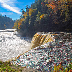
Tahquamenon Falls State Park encompasses nearly 50,000 acres and stretches 13-plus miles in Michigan's Upper Peninsula. The park is home to multiple campgrounds, overnight lodging facilities, a boat launch, more than 35 miles of trails and multiple overlooks to the Upper and Lower Falls.
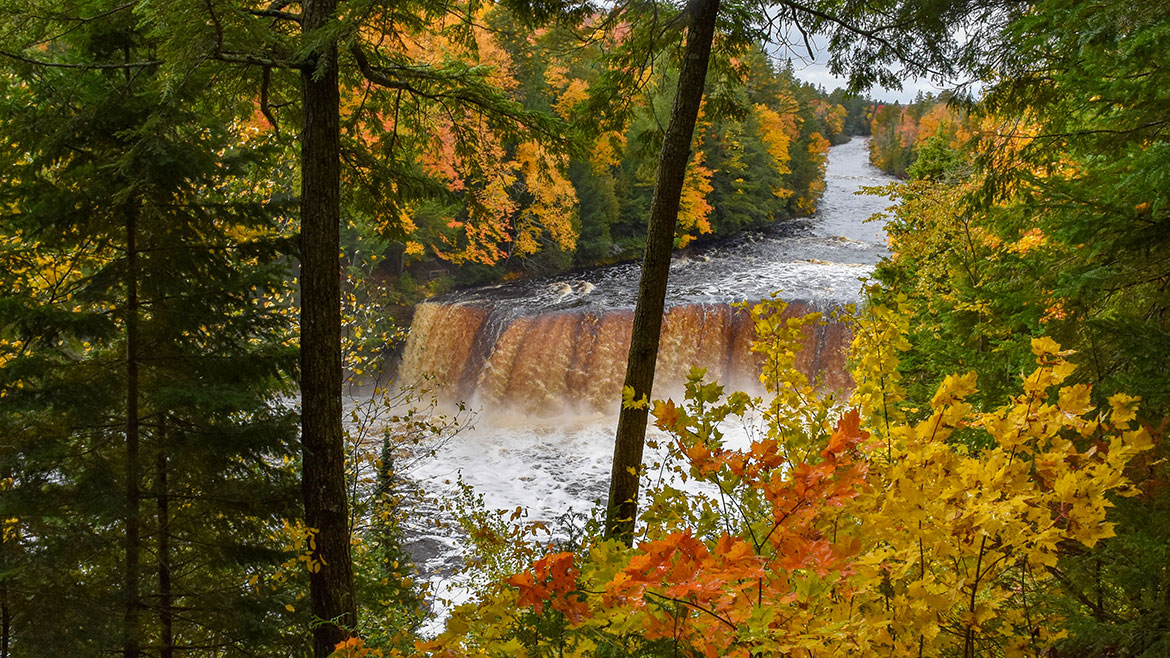
The 200-feet-wide Upper Falls is one the largest waterfalls east of the Mississippi River. The river’s amber color is caused by tannins leached from the cedar, spruce and hemlock trees in the swamps drained by the river, and the extremely soft water churned by the action of the falls causes the river’s trademark large amounts of foam. Just 4 miles downstream is the Lower Falls, consisting of a series of five smaller falls cascading around an island. The falls can be viewed from the riverbank, all-accessible Ronald A. Olson Island Bridge over the Tahquamenon River or by a rowboat rented from a park concession. Drone use is prohibited.
Black bear, coyote, otter, deer, fox, porcupine, beaver and abundant bird life, including spruce grouse, pileated woodpeckers, bald eagles and a variety of waterfowl and songbirds can be found in the park. Moose are occasionally seen feeding in the wet areas of the park, especially along M-123 between Paradise and the Lower Falls.
- Tahquamenon Falls State Park [Michigan DNR]
Muskallonge Lake State Park
Luce County
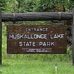
Location: 29881 Co Rd 407 - Newberry MI, 49868
Size: 217 Acres
Camping: 159 Modern Campsites
Muskallonge Lake State Park is located 28 miles northwest of Newberry in Luce County. The 217-acre park is situated between the shores of Lake Superior and Muskallonge Lake and the area is well known for its forests, lakes and streams. Muskallonge Lake State Park was the former site of Deer Park, a lumbering town in the late 1880s, and prior to its lumbering history, an Indian encampment. Muskallonge Lake was a mill pond for millions of white pine logs that were brought to it by railroad lines. By 1900, the virgin stands of pines were depleted, the mill was closed and the lumbering operation moved away. All that remains as evidence of the lumbering community are piles of sawdust and a few partly submerged pine logs in the lake. The park was also the old site of a Coast Guard Life Saving Station.
- Muskallonge Lake State Park [Michigan DNR]
Indian Lake State Park
Schoolcraft County
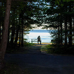
Location: 8970 W County Road 442 - Manistique MI, 49854
Size: 567 Acres
Camping: 145 Modern Campsites, 72 Semi-Modern Campsites, 2 Mini Cabins
Indian Lake State Park is located on the shores of Indian Lake, five miles west of Manistique in Michigan’s Upper Peninsula. This 567-acre park is composed of two units, which are 3 miles apart and separated by the lake. The south unit features a modern campground overlooking the lake and the west unit features semi-modern campsites in a wooded setting. Other amenities include two Civilian Conservation Corps-era picnic shelters, a designated swim beach, a quarter-mile, paved trail along the lake and boating access site.
Indian Lake, which is 6 miles long and 3 miles wide, is the fourth-largest inland lake in the Upper Peninsula. The lake was once called M'O'Nistique Lake, and surveyor records from 1850 indicate Native Americans lived in log cabins near the outlet of the lake.
- Indian Lake State Park [Michigan DNR]
- Indian Lake State Park [Visit Manistique]
Palms Book State Park
Schoolcraft County

Location: M-149 (a mile north of the Co Rd 455 junction) - Manistique MI, 49854
Size: 388 Acres
Palms Book State Park, located at the north end of Indian Lake in Michigan's Upper Peninsula, is home to Kitch-iti-kipi or "The Big Spring." This renowned natural attraction is Michigan’s largest freshwater spring with more than 10,000 gallons of water per minutes gushing through fissures in the underlying limestone at a constant 45 degrees Fahrenheit. By means of a self-guided (accessible) observation raft, visitors can view this crystal-clear pool with an emerald green bottom.
Concessions and souvenirs are available at a store open seasonally and a boating access site provides access to Indian Lake (the Upper Peninsula’s fourth-largest inland lake).
The observation raft if open 8 a.m. to dusk. It's prohibited to swim, bathe, skin or scuba dive, fish, boat, enter, or place or launch any object (including underwater cameras) in the "The Big Spring," or use the raft for anything other than viewing.
- Palms Book State Park [Michigan DNR]
- Kitch-iti-kipi [Visit Manistique]
Fayette Historic State Park
Delta County

Location: 4785 II Road - Garden MI, 49835
Size: 711 Acres
Camping: 1 Lodge, 61 Modern Campsites
Find unmatched scenery and take a walk back in time at Fayette Historic State Park. Blending history and nature, the park is located on the shores of Big Bay de Noc – on Lake Michigan between Snail Shell Harbor and Sand Bay – on the southern side of Michigan’s Upper Peninsula.
Visitors will also find a historic townsite, a modern campground, Snail Shell Harbor, a visitor center, a boating access site, a designated swim area and more. The park’s 5 miles of trails offer impressive views from 90-foot limestone cliffs that surround the harbor.
Fayette Historic Townsite represents a once-bustling industrial community that manufactured charcoal pig iron between 1867 and 1891 at the tip of the Garden Peninsula. Visitors may walk through the well-preserved buildings that have been standing for 150 years and learn about life during the 19th century. There are self-guided and guided tour options (summer months only) available.
- Fayette Historic State Park [Michigan DNR]
- Fayette Historic State Park [Visit Manistique]
Wells State Park
Menominee County
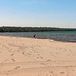
Location: N7670 Highway M-35 - Cedar River MI, 49887
Size: 678 Acres
Camping: 150 Modern Campsites, 5 Rustic Cabins, Stone Lodge
Wells State Park is located on Green Bay about 30 miles south of Escanaba. Its 678 acres include a three-mile shoreline with beautiful sandy beach for swimming, a large picnic area, a modern campground and rustic cabins. The park, established in 1925, was donated to the State of Michigan by the children of John Walter Wells, a pioneer lumberman in the area. In addition to owning several lumber companies and sawmills, he served a mayor of Menominee for three terms beginning in 1893. Many of the park's buildings, landscaping and water and sewage systems were built by the Civilian Conservation Corps in the 1930s and 1940s. The park is open year round, even when the campground is closed, providing opportunities for winter recreation such as cross-country skiing, snowshoeing and ice fishing.
Wells State Park has opened a modern lodge that sleeps ten. Contact the park for more information.
- Wells State Park [Michigan DNR]
Bewabic State Park
Iron County
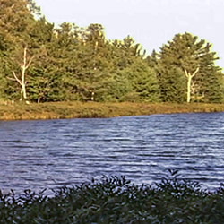
Location: 720 Idlewild Rd. - Crystal Falls MI, 49920
Size: 315 Acres
Camping: 4 Semi-Modern Campsites, 130 Modern Campsites
Bewabic State Park is situated on Fortune Lake, which is part of the Fortune Lakes Chain. The park is home to both modern and rustic campsites, a day-use area, a tennis court, hiking trails, a boat launch and more. The park is rich with Civilian Conservation Corps history, which is evident by several CCC structures still in use.
Bewabic is one of just a few state parks that allow the operation of an ORV between the campground and nearby ORV trails. The park connects to Twin Lakes and Baraga state parks and Bond Falls Scenic Site via several motorized routes. Please note: ORV use is for exiting and entering the park only, not for traveling within the park.
- Bewabic State Park [Michigan DNR]
Porcupine Mountains Wilderness State Park
Ontonagon County

Location: 33303 Headquarters Road - Ontonagon MI, 49953
Size: 59,020 Acres
Camping: 64 Rustic Campsites, 65 Backcountry Campsites, 19 Rustic Cabins, 100 Modern Campsites, 4 Yurt Campsites, Modern Lodge, 2 Group Sites
Porcupine Mountains Wilderness State Park – fondly known as "the Porkies" – features 60,000 acres of old-growth forest, roaring waterfalls, Lake Superior shoreline, rivers, trails and ridges. The park’s incomparable vistas make Michigan’s largest state park a popular destination for camping, hiking, snowmobiling, fishing and more. The park boasts many popular natural attractions, including Lake of the Clouds and the scenic Presque Isle River corridor. Other attractions include the Summit Peak observation tower, Porcupine Mountains Winter Sport Complex, fall chairlift rides, an 18-hole disc golf course and more.
- Porcupine Mountains Wilderness State Park [Michigan DNR]
McLain State Park
Houghton County
Location: 18350 Highway M-203 - Hancock MI, 49930
Size: 443 Acres
Camping: 98 Modern Campsites, Rustic Cabin
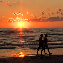
McLain State Park is situated in the heart of the Keweenaw Peninsula on beautiful Lake Superior and is centrally located between the cities of Calumet and Hancock. The park offers two miles of sand beach on Lake Superior. Visitors can also enjoy a variety of activities in the park: fishing, windsurfing, berry picking, beachcombing, rock hounding, sight-seeing and hunting. The sunsets at McLain State Park are spectacular and the view of the lighthouse is magnificent.
- McLain State Park [Michigan DNR]
Fort Wilkins Historic State Park
Keweenaw County

Location: 15223 U.S Highway 41 - Copper Harbor MI, 49918
Size: 700 Acres
Camping: Cabin, 4 Group Use Sites, 159 Modern Campsites
Fort Wilkins Historic State Park, located in the northern tip of the Keweenaw Peninsula, features a modern campground, trails, a historical fort with a living history program, two 1860s lighthouses on Lake Superior and much more.
Visitors will enjoy a quarter-mile of rocky Lake Superior shoreline, Lake Fanny Hooe and a quarter-mile of sandy beach on Lake Manganese. The park features a restored 1844 army military outpost, including 19 buildings, with a living history program provided by the Michigan History Center. Visitors can experience a look back at life on the northern frontier during the mid-1800s and a time when soldiers were stationed in Michigan's Upper Peninsula.
- Fort Wilkins Historic State Park [Michigan DNR]
Van Riper State Park
Marquette County
Location: 851 County Road AKE - Champion MI, 49814
Size: 1,055 Acres
Camping: Camper Cabin, 143 Modern Campsites, 39 Rustic Campsites, Rustic Cabin, 2 Mini Cabins
Van Riper State Park is located 35 miles west of Marquette off of U.S. 41. This1,055-acre park is home to 1.5 miles of waterfront on both Lake Michigamme and the Peshekee River.
The park features a designated swim beach, a bicycle pump track, an accessible playground, trails, picnic areas, a paved trail to historic Champion and more. The park is popular for its designated swim beach that features a fine sandy shoreline and moderate water temperatures - a sometimes pleasant change from Lake Superior temperatures.
- Van Riper State Park [Michigan DNR]
Craig Lake State Park
Baraga County
Location: Intersection of Nelligan Lake Road and US 41 - Champion MI, 49814
Size: 9,732 Acres
Camping: Yurts, 22 Backcountry Campsites, 2 Rustic Cabins
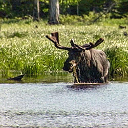
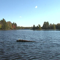
Craig Lake State Park is the most remote in Michigan’s state park system, spanning more than 9,700 acres in Baraga and Marquette counties. The park is home to hike-in backcountry campsites (reservations only), yurts, rustic cabins, many miles of trail, including the North Country Trail, six lakes, and a variety of wildlife. Visitors may be lucky enough to see the elusive moose that spend their spring, summer and fall seasons within the park.
The park's rugged and natural beauty can make access into the park somewhat challenging. Vehicles with high-ground clearance and four-wheel drive are strongly recommended due to the rocky conditions of the road. In 2022, the U.P. Land Conservancy gifted nearly 1,300 acres of pristine highlands wilderness to the park, which includes three parcels that made up the conservancy’s Peshekee Headwaters Nature Preserve along the eastern edge of the park.
There are six lakes in the park, three of them named for the children of Frederick Miller of the famed Miller Brewing Company, numerous small ponds and a variety of wildlife such as deer, black bears, beavers, loons and moose. Craig Lake is 374 acres and features six islands and high granite bluffs along its northern shoreline. In keeping with the Miller beer theme, a nearby lake located northwest of the park is named High Life Lake.
- Craig Lake State Park [Michigan DNR]
Laughing Whitefish Falls State Park
Alger County
Location: M-94 and Sundell Rd intersection - Sundell MI, 49885
Size: 960 Acres
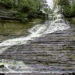
Laughing Whitefish Falls is one of the Upper Peninsula's many impressive waterfalls. The falls cascade through a picturesque gorge with old-growth white pine and hemlock trees towering above. There are three observation platforms to view the falls from different levels, which can be reached by a half-mile hike through beech-maple forest (1 mile round-trip). The upper observation platform does not have any stairs leading to it, and a wooden staircase leads to the middle (20 stairs from the top) and lower (137 stairs from the top) observation platforms.
There is a charcoal grill and hand pump for water near the parking area; however, please pack all trash out with you as there are no trash cans. Pets are welcome but must always be on a 6-foot leash and under an owner’s immediate control. All pet waste must be packed out to be properly disposed of later.
- Laughing Whitefish Falls State Park [Michigan DNR]

